Decarb Geoservices — Tech is yours
Services

The right instruments, used responsibly.

From a single targeted survey to a fully integrated geotechnical campaign, we combine non-invasive geophysics with drilling and consulting to deliver clarity on the subsurface.

Geophysical Services

Environment-friendly geophysical surveys for geo-hazard detection, soil analysis and geotechnical drilling integration.

Explore methods →

Geotechnical Consulting

Drilling activities and core description integration for construction site design and optimization.

Explore methods →

Environmental Hub

Geothermal, wind, solar, waste, coral reefs and hydrology — geoscience for the energy transition.

Explore methods →
Techniques

Nine proven methods.

Electric Resistivity Tomography (ERT)
01

Electric Resistivity Tomography (ERT)

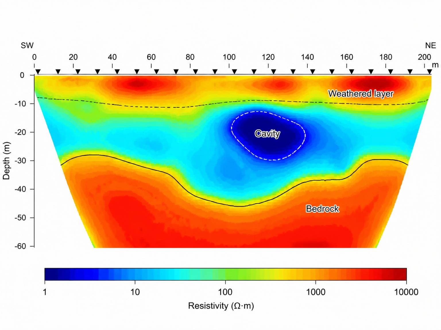
A multi-electrode profiling technique that records hundreds of subsurface data points to produce a two-dimensional cross section of the earth.

Mapping applications
  • Bedrock fracture zones
  • Fault zones
  • Delineating tunnels and cavernous zones
  • Contamination plumes
  • Characterizing landfills
  • Water table determination
  • Archaeological investigations
Ground Penetrating Radar (GPR)
02

Ground Penetrating Radar (GPR)

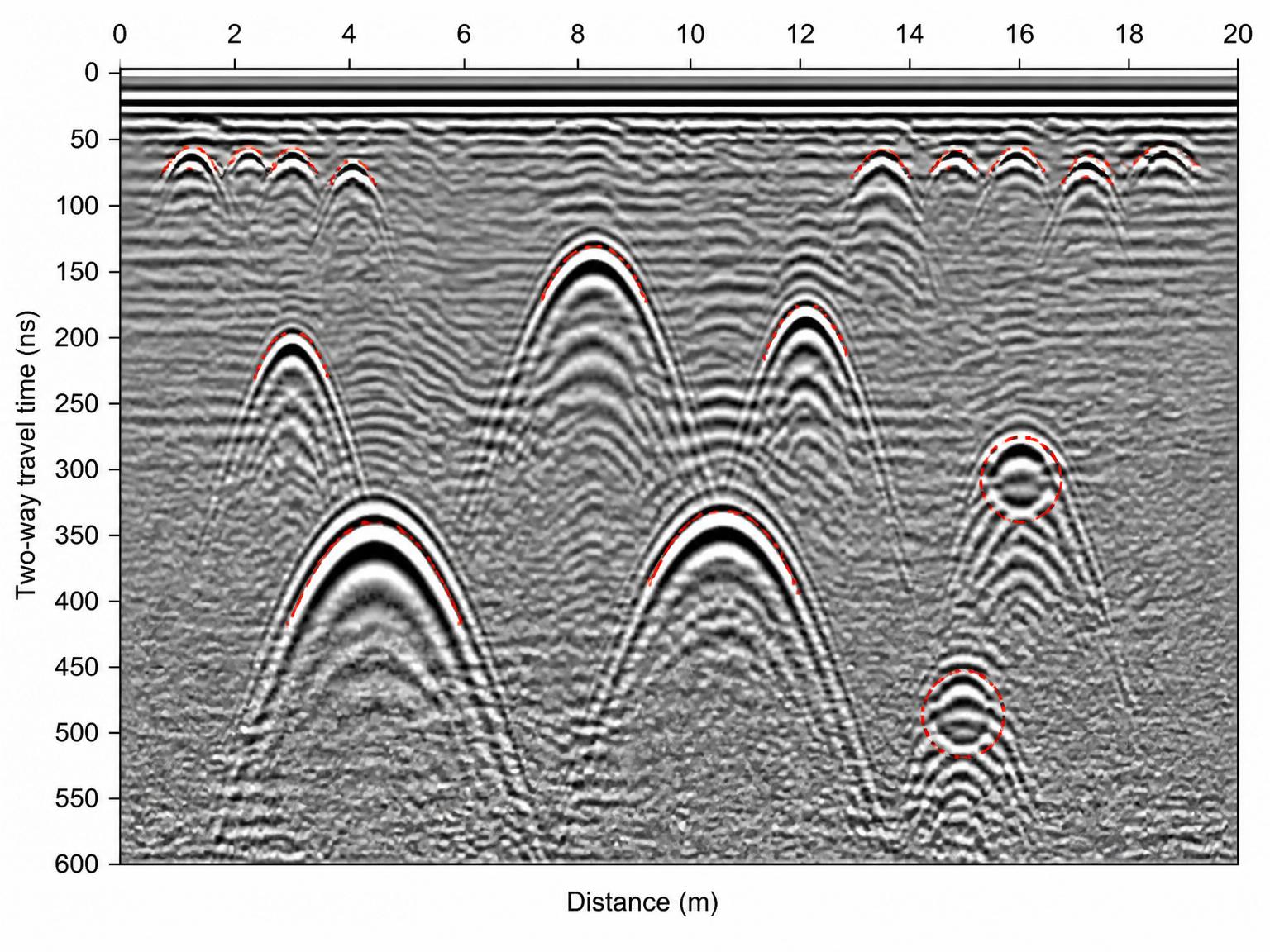
Pinpoints the location of buried objects — metal and non-metal — and locates voids. A radar record provides a permanent, detailed picture of size, location and depth.

Mapping applications
  • Mapping voids/cavities beneath pavement or behind retaining walls
  • Locating underground utilities
  • Locating buried tanks and drums
  • Measuring pavement thickness
  • Detecting pile locations
  • 3D rebar mapping
  • Archaeological investigations
Vertical Electrical Sounding (VES)
03

Vertical Electrical Sounding (VES)

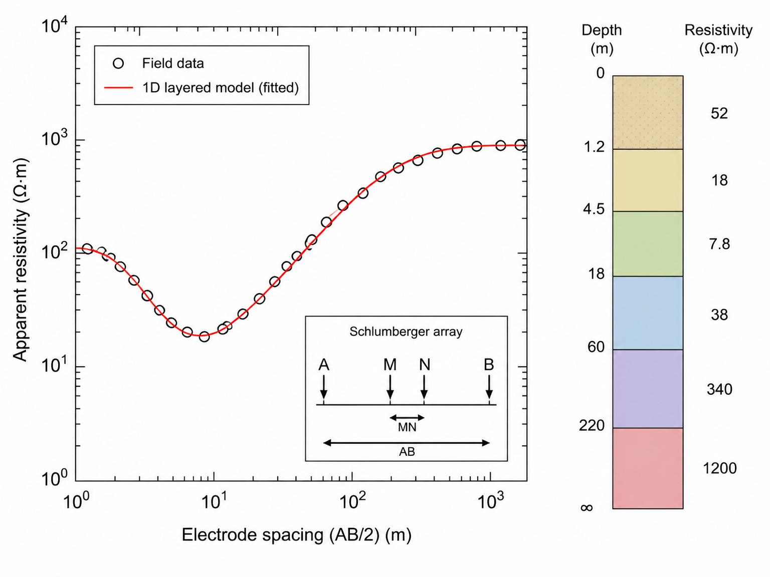
One of the most widely used geo-electric methods — cost-effective with strong results across many areas of interest.

Mapping applications
  • Aquifer description
  • Bedrock depth
  • Mapping geological boundaries
  • Identifying fractures in bedrock
  • Sand and gravel deposit mapping
  • Mineral exploration
  • Groundwater depth and contamination
  • Saline soil mapping
Cross-Hole Seismic
04

Cross-Hole Seismic

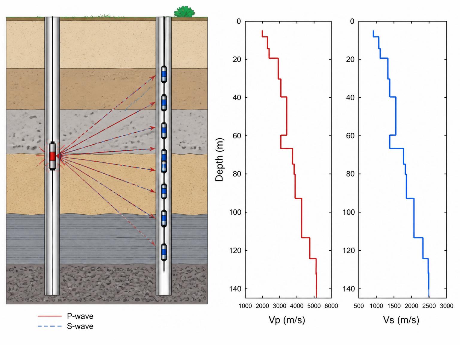
Provides a depth profile of shear- and compressional-wave velocities between boreholes at high vertical resolution — key for soil dynamic parameters.

Mapping applications
  • Subsurface modelling
  • Site classification per DIN 4428
  • Elastic soil parameters and Young's modulus
  • Predicting soil response to dynamic loading
Seismic Refraction Surveys
05

Seismic Refraction Surveys

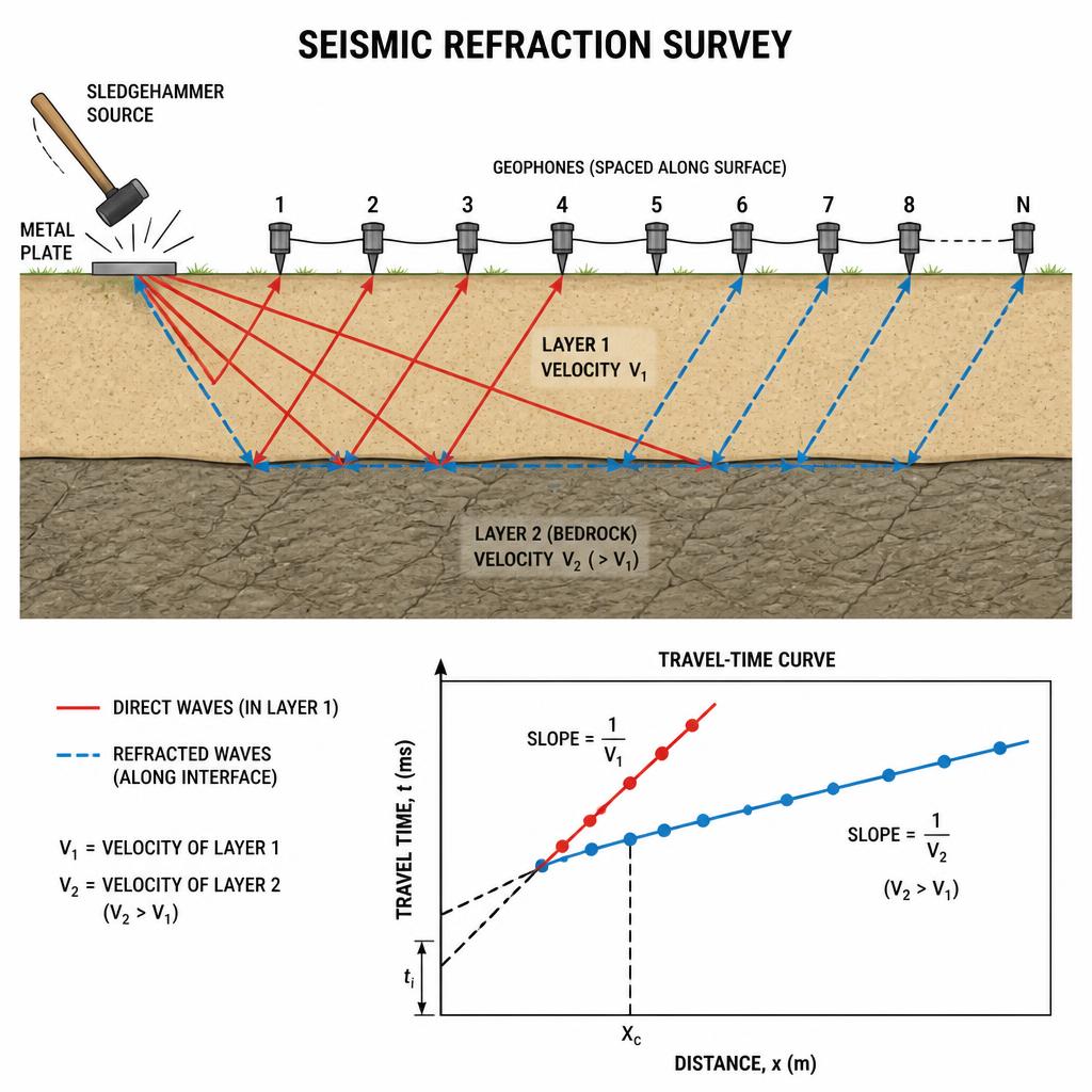
Investigates the subsurface by generating arrival time and offset distance information to determine the path and velocity of elastic disturbances in the ground.

Mapping applications
  • General geologic structure
  • Water table depth
  • Bedrock depth
  • Identification of fractures in bedrock
  • Sand and gravel deposits
  • Overburden thickness
Shallow Seismic Reflection
06

Shallow Seismic Reflection

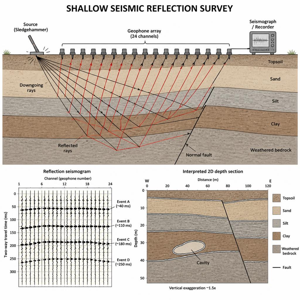
Maps subsurface layers by measuring reflected elastic waves — used for cavity detection, faults, fracture modelling and rock/soil boundary identification.

Mapping applications
  • General geologic structure
  • Water table and bedrock depth
  • Fracture and fault identification
  • Sand and gravel deposits
  • Overburden thickness
  • Cavity and karst detection
Multichannel Analysis of Surface Waves (MASW)
07

Multichannel Analysis of Surface Waves (MASW)

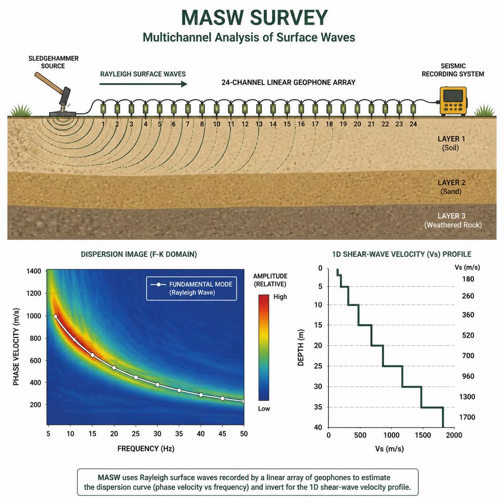
A non-invasive seismic method that analyses the dispersive nature of Rayleigh (surface) waves to derive shear-wave velocity profiles of the near-surface.

Mapping applications
  • Seismic site classification
  • Shear-wave velocity profiling
  • Bedrock depth and layering
  • Liquefaction potential assessment
  • Geotechnical parameter estimation
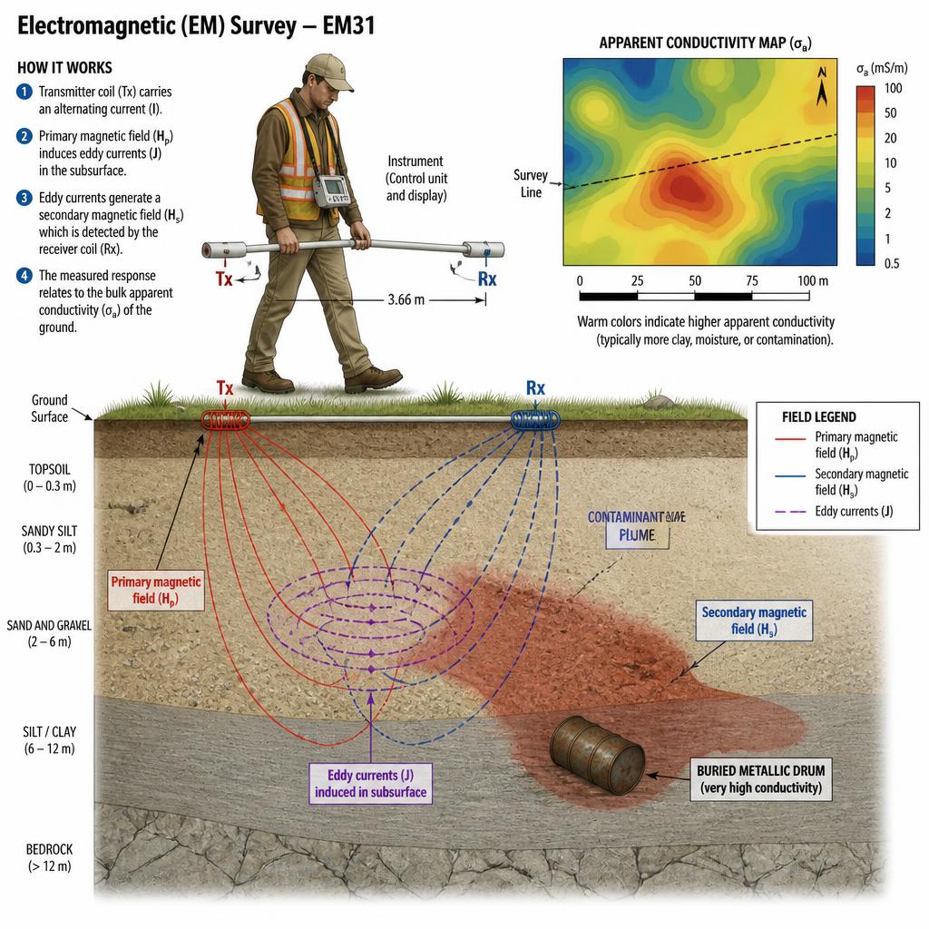
Electro-Magnetic Surveys
08

Electro-Magnetic Surveys

Maps variations in electrical conductivity by measuring the subsurface response to electromagnetic fields — inferring composition, structure, moisture and fluid content.

Mapping applications
  • Groundwater exploration and mapping
  • Contaminant plume detection
  • Buried object and utility detection
  • Geological and structural mapping
  • Soil and mineral characterisation
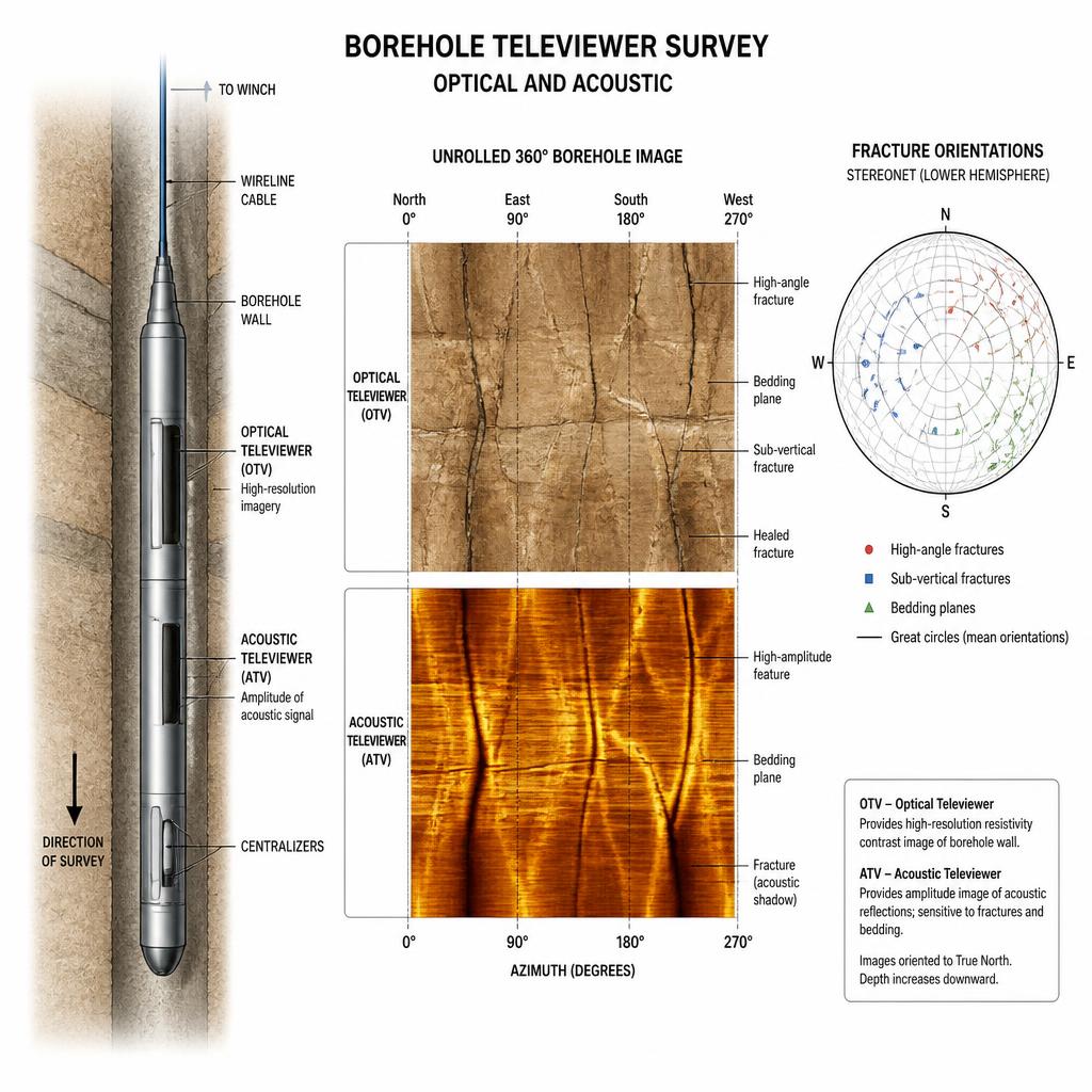
Tele-Viewer (Optical & Acoustic) Surveys
09

Tele-Viewer (Optical & Acoustic) Surveys

Borehole logging tools that produce continuous, oriented images of the borehole wall to characterise subsurface structure in situ.

Mapping applications
  • Fracture characterisation
  • Structural and stratigraphic logging
  • Borehole and casing integrity
  • In-situ stress analysis
  • Borehole correlation and integration
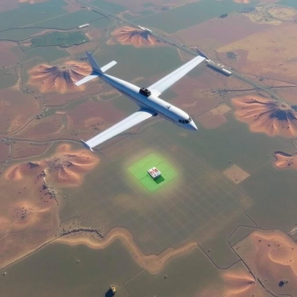
Aero-Geophysical Surveys
010

Aero-Geophysical Surveys

Airborne magnetic, electromagnetic and radiometric surveys flown by fixed-wing aircraft and UAVs — covering large or inaccessible areas rapidly with consistent, high-density data.

Mapping applications
  • Regional geological mapping
  • Mineral and groundwater exploration
  • Structural and fault mapping
  • Pipeline and corridor reconnaissance
  • Environmental baseline mapping
  • Inaccessible-terrain coverage
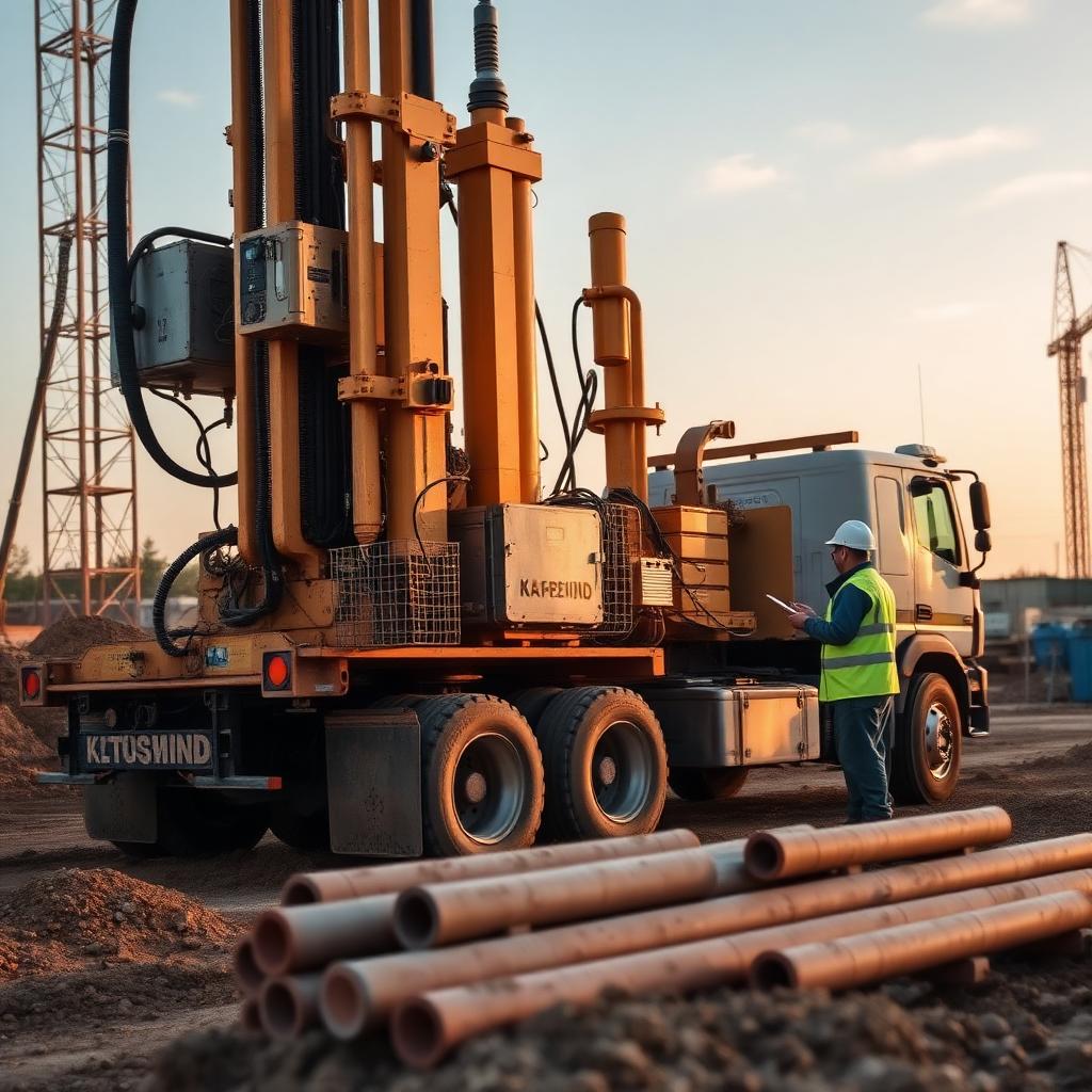
Geotechnical Drilling
011

Geotechnical Drilling

Rotary and percussion drilling with continuous core recovery, SPT and in-situ testing — calibrating geophysical models with direct ground-truth for foundation and infrastructure design.

Mapping applications
  • Soil and rock core sampling
  • Standard Penetration Test (SPT)
  • Borehole installation for in-situ testing
  • Foundation and bearing capacity assessment
  • Groundwater monitoring well installation
  • Ground-truthing geophysical surveys
Service & Utility Mapping
012

Service & Utility Mapping

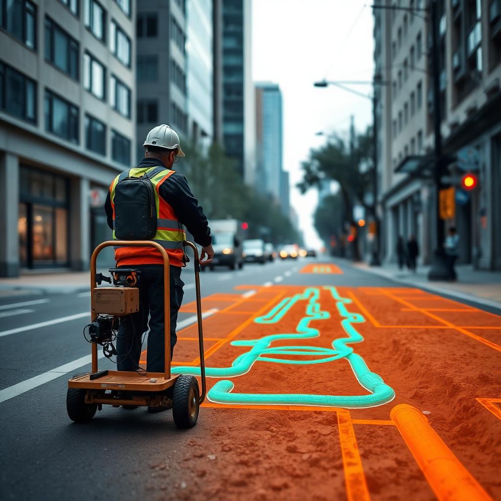
Multi-sensor detection and mapping of buried utilities — pipes, cables, ducts and conduits — combining GPR, EM locators and GPS to deliver accurate as-built 2D/3D site records.

Mapping applications
  • Buried utility detection and tracing
  • Pre-construction clearance surveys
  • PAS 128 utility surveys
  • 2D/3D as-built site mapping
  • Damage prevention and risk reduction
  • Underground asset management
Environmental Hub

Applied to the energy transition and the planet.

We bring the same instruments to renewable energy, water resources and environmental protection — closing the loop between subsurface intelligence and sustainable outcomes.

Geothermal Site Characterisation

Geothermal Site Characterisation

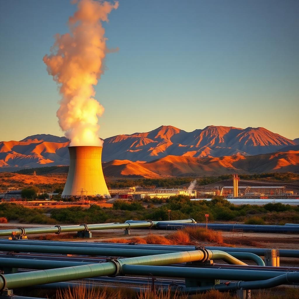
Integrated assessment of the subsurface thermal regime and the geological, hydrogeological and petrophysical properties that control heat storage and transfer — to evaluate a site's geothermal potential.

Applications
  • Thermal resource assessment
  • Thermal property determination
  • Reservoir and aquifer characterization
  • Heat source and structural mapping
  • Monitoring and sustainability evaluation
Wind Farm Site Characterisation

Wind Farm Site Characterisation

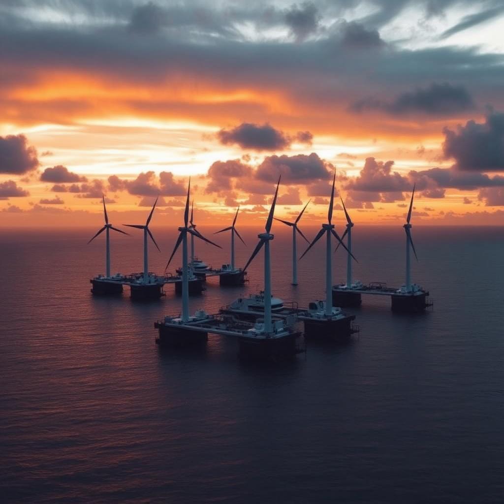
Geological, geotechnical, geophysical and metocean assessment for the safe and economical siting, design and installation of onshore and floating offshore wind turbines and associated infrastructure.

Applications
  • Foundation design and turbine siting
  • Geohazard identification
  • Seabed and sub-seabed mapping (offshore) for floating wind farms
  • Cable route assessment
  • Geotechnical parameter derivation
Solar Panels Site Characterisation

Solar Panels Site Characterisation

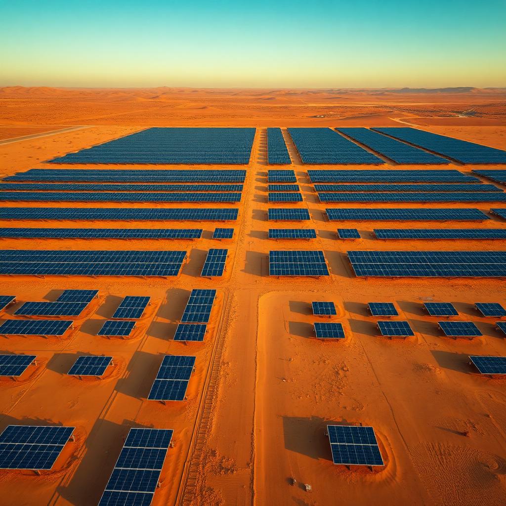
Combined solar resource, terrain, geotechnical and environmental assessment for the reliable siting, design and installation of photovoltaic arrays and supporting infrastructure.

Applications
  • Geotechnical and foundation design
  • Soil corrosivity and resistivity testing
  • Geohazard and ground-condition screening
  • Terrain, topography and drainage analysis
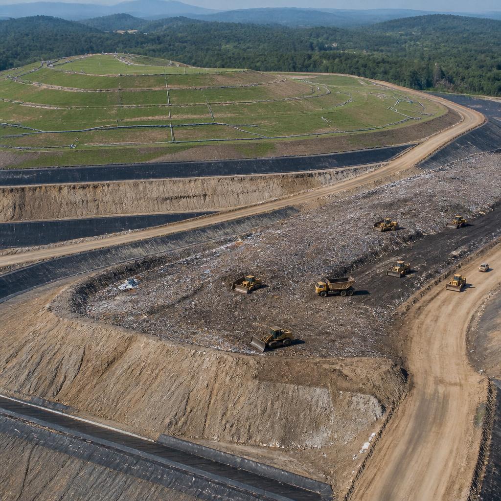
Waste Management Site Characterisation

Waste Management Site Characterisation

Geological, geophysical, hydrogeological and geotechnical assessment of landfills, dumpsites and contaminated areas — for safe siting, design, monitoring and remediation.

Applications
  • Landfill siting and design
  • Leachate and contaminant plume mapping
  • Waste body and boundary delineation
  • Groundwater and geohazard monitoring
  • Containment and liner integrity monitoring
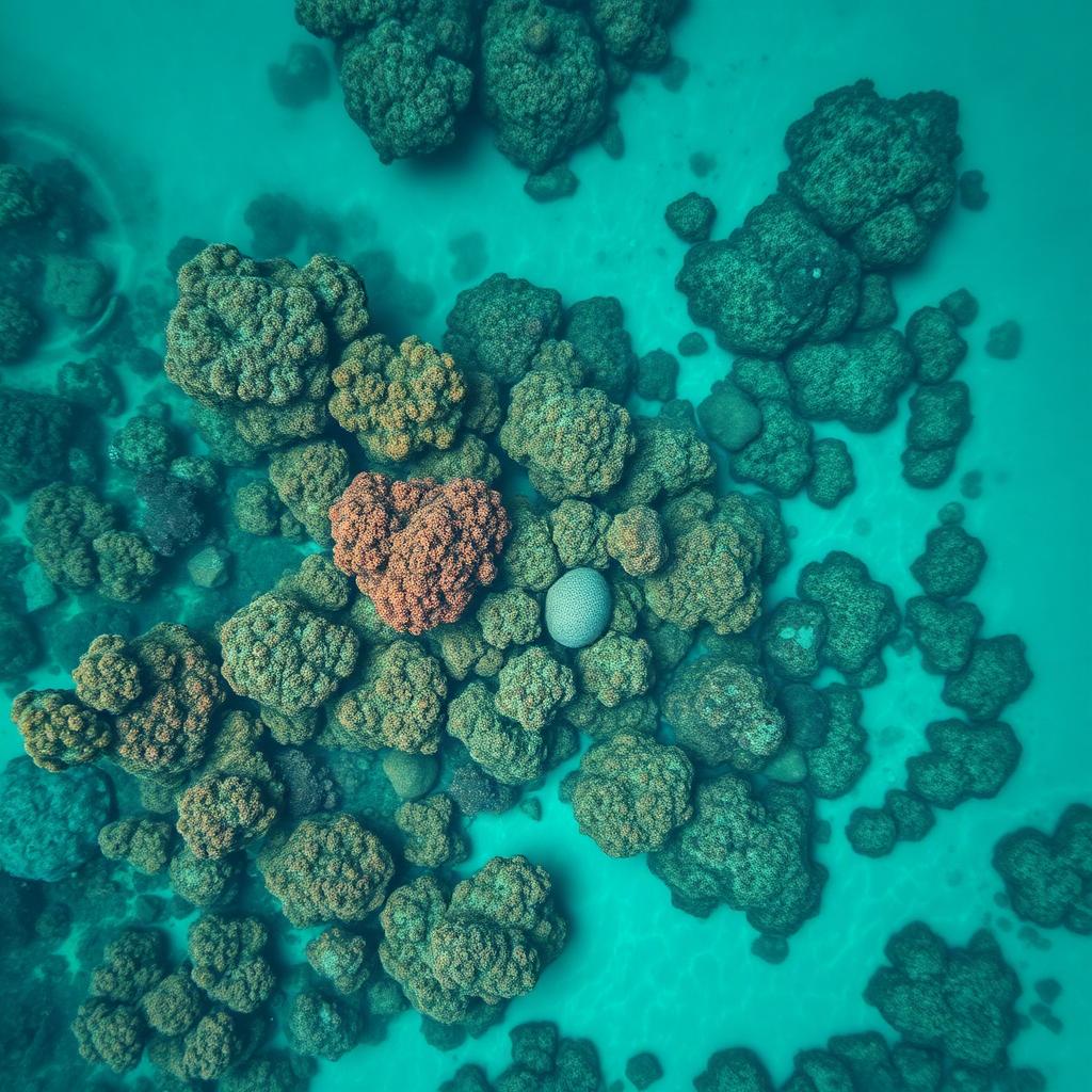
Coral Reefs Modelling

Coral Reefs Modelling

Geophysical, geospatial and geotechnical characterisation of reef structures and the surrounding seabed — mapping extent, morphology, depth and internal architecture.

Applications
  • Reef extent and morphology mapping
  • Sub-reef stratigraphy and boundary detection
  • Marine route and infrastructure planning
  • Geohazard and foundation assessment
  • Environmental baseline and monitoring
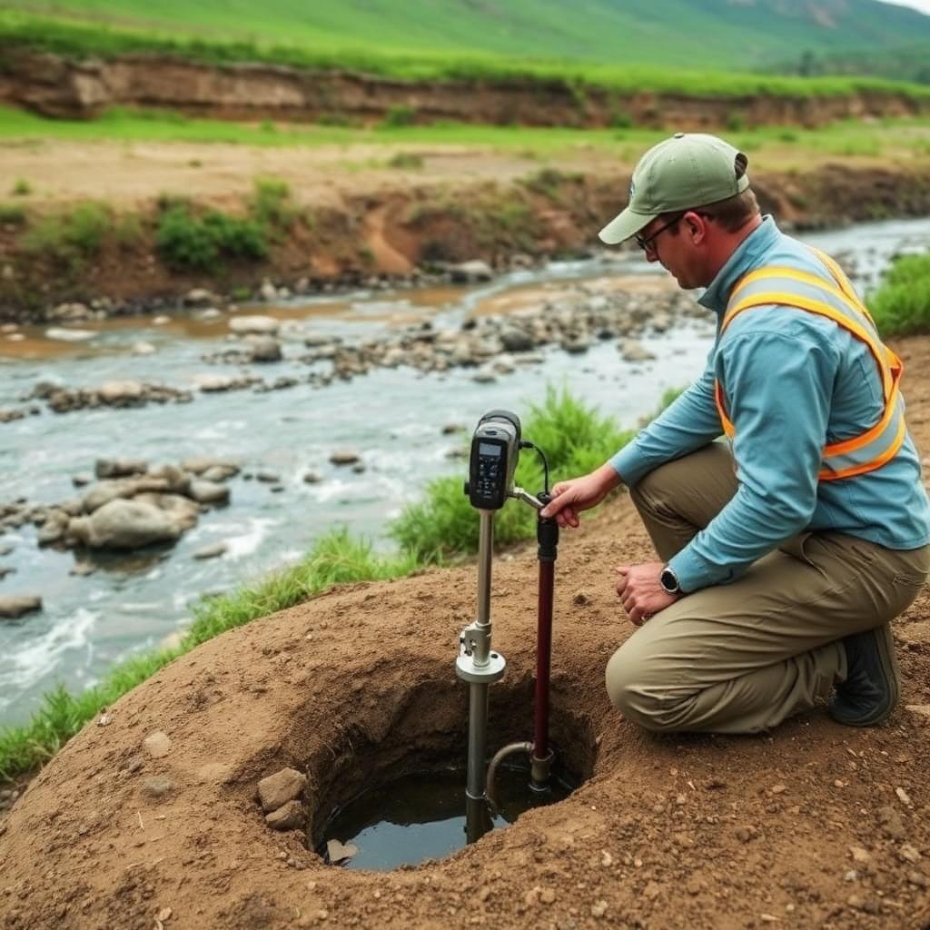
Hydrology Site Characterisation

Hydrology Site Characterisation

Aquifer mapping, water-table and groundwater-flow assessment, well siting, contamination and salinity assessment, plus recharge and resource management.

Applications
  • Aquifer mapping and characterization
  • Water-table and groundwater-flow assessment
  • Groundwater exploration and well siting
  • Contamination and salinity assessment
  • Recharge, vulnerability and resource management